
On the Car Horns of a Dilemma - Day 3
Day 3*
I dragged myself out of the car into the cold morning air after my mostly sleepless night, grabbed a towel and toiletries and headed over to the building with the toilet and shower. Unfortunately, it had been so cold recently that a pipe burst, and neither the toilet nor the shower was operable. The owners kindly offered me a discount for the trouble, and I was back on the road: tired, dirty and on the lookout for a public restroom.
The next stop was St. George Island State Park on St. George Island, Fla., a three-and-a-half-hour drive south, meaning at least five hours as the Chuck drives. In keeping with my vow to go through small towns instead of around them, I took Rt. 27 East into Richland, Ga., hoping to find a nice little coffee shop for a cup of joe and maybe breakfast sandwich. Sadly, I timed my arrival poorly, because the Richland coffee shop had already closed around… 1989?

Fig. A: Richland, Ga.
Apparently Richland was the shit back when bat guano was all the rage in the parlours of socialites in Atlanta and Charleston.

Fig. B: The receipts for the next set of jokes
But the hot guano market had cooled (one might even say it stinks now) and, with it, it seems, cooled Richland’s fortunes.
BUT I am told by Google that Richland is experiencing a renaissance, thanks in part to the Richland Distilling Company, maker of the very well-regarded Richland Rum, offered in five variations. I drove by the facility and, being a rum lover myself, I would have enjoyed a stop, but it was 8:30 a.m. and I had to get south. If you are ever in Richland, dear reader, give it a try. I don’t think there is a guano flavor though.
I then continued east to Plains, Ga., which is NOT where our greatest ex-president, Jimmy Carter, is from. I was told in no uncertain terms by a sign at President Carter’s boyhood home that he was from Archery, Ga., about three miles west of Plains.
Fig. C: This may look big, but trust me it wasn’t.


I didn’t get a chance to check the fridge for Billy Beer. Actually, I don’t think there was a fridge.
After wandering around the park that includes the modest Carter family home, I headed into Plains, passing the former president’s current home, protected by fences and gates that I’m sure the gentle man wishes were not necessary. [Retroactive note: Sadly, just prior to my posting this, former President Carter did in fact die in that house. So the rest of this commentary is 365 days late and probably discomfiting, but in the name of art, and of not rewriting, I’m keeping it.]
It made me sad to drive by the house where President Carter is even now in hospice care, and has been for more than a year. But it doesn’t seem out of character. Recall that Mother Theresa took advantage of the global grieving following Princess Diana’s death to pull the ultimate “Macedonian Goodbye,” shuffling out a side door and off this mortal coil while we weren’t looking.
Not the attention-seeking sort, I’ll bet President Carter is using the equally effective “Sunset See Ya’” technique in which, like a sunset, he’s going down, down, down and then you glance away for a second and when you turn back, he’s gone. [Retroactive note: Turns out Carter didn’t pull the Sunset See Ya’, but instead employed the surprisingly more aggressive “I Ain’t Sticking Around For Another One of These.”]
From Plains I turned south onto Rt. 45 to Dawson, then south on Rt. 55 through Herod and Leary. In Leary I passed a wild-eyed guy standing on a corner, absolutely losing it, screaming, yelling, waving his arms and punching at the sky. It was surprising, but shouldn’t have been, to see in a small town rather than a bigger city.
One of my challenges on a road trip is the constant sense of FOMOOBR, or “fear of missing out on back roads.” Every intersection presents me with impossible choices – do I follow the route laid out by Google Maps (which already avoids highways) or to I take this next turn for a slightly longer, but potentially more interesting, route?
For example: here is an actual FOMOOBR dilemma just outside the Five Forks Peanut facility, near Anna, Ga.

Fig. D: OH MY GOD FOMMOBR!!!
Google Maps wants me to go down that narrow, two-lane country road straight ahead. But I feared if I did that, I’ll miss something really cool down that similarly narrow, two-lane country road to the left! And that is one of the regrets of life: there isn’t enough time, or time-space continuum, to do everything. As Oliver Burkeman says in my favorite book of all time, “4,000 Weeks: Time Management for Mortals”:
“As I make hundreds of small choices throughout the day, I’m building a life—but at one and the same time, I’m closing off the possibility of countless others, forever. (The original Latin word for “decide,” decidere, means “to cut off,” as in slicing away alternatives; it’s a close cousin of words like “homicide” and “suicide.”) Any finite life—even the best one you could possibly imagine—is therefore a matter of ceaselessly waving goodbye to possibility.”
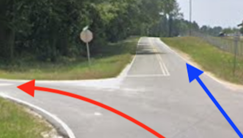
Fig. E: Help me, Robert Frost! Help me, Oliver Burkeman! Tom Cruise, use your witchcraft on me! Help me, Oprah Winfrey!
In the end I jumped the Google Tracks and went left, earning a little reinforcement from my brother-in-law, Lee:
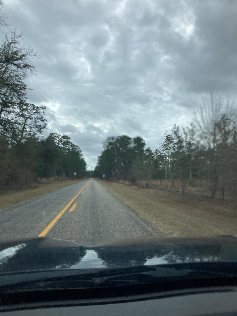
Fig. F: “Now that’s the kind of road to take on a road trip!!!” - Lee
Eventually I ended up on Rt. 253, through the fancy little gentrified golf-cart town of Bainbridge, which I’m sure has some fine breweries, and on down Rt. 300 to Rt. 65 and the Florida George Line.

Fig. F: The Florida-Georgia Line
No, the other Florida Georgia Line…

Fig. G: Oh, sorry. This one?
Yes, that one.
I crossed the skinny part of the Florida panhandle on Rt. 65, through the town of Quincy and the county of Gadsden (where I expected the streets to be lined by Gadsden flags but saw not a one), the landscape around me getting flatter and sandier as I drove. Going through Tate’s Hell State Forest, I saw several groups of hunters standing on top of their pick-up trucks, peering into the swampy woods with binoculars, no doubt looking for a reality show to star in.
The temperature had steadily risen into the 70s as I made my way south. But radar was showing a north-south line of strong storms sweeping east, and I wondered if I’d reach my St. George State Park campsite before the storms hit.
Finally, at 3 p.m., I got to the end of Rt. 65 as it T-ed into Rt. 98. I was staring straight ahead at the Gulf of Mexico. Or is it the Gulf of Flexico? Since I guess we can just start renaming stuff whatever we want, how about the Gulf of Can’t Prioritize Important Issues? And, as someone said recently, if changing the name of this body of water is no biggie, then what’s your hang up on pronouns?
ANYWAY, the blue-grey water matched the blue-grey clouds scudding overhead, in the van of the approaching storm front. And in the hours after the front passed through, temperatures were expected drop, down into the 50s that night, then much lower in the days and nights to follow.

Fig. H: El Golf du Mexique, taken with the same camera that captured the iconic Big Foot picture.
I have to admit I was a little bummed to arrive at the Gulf of Mexico just before a cold snap. For the past ten years or so, at some point every January or February I would ask friends for recommendations of nice little beach towns, with the idea that I might bail on the Virginia winter for warmer climes for a bit. Now I’d done exactly that, and the climes weren’t all that warm, or wouldn’t be shortly.
At the same time, it was thrilling to see the vast Gulf filling my windshield, with my destination of St. George Island darkening the far horizon. I thought about how we can’t choose the weather, but we can choose whether we stay at home or strike out on travels, and whether the weather is what we want is just part of the interesting unknown that comes with choosing to live proactively.
I turned west onto Rt. 98 and rode through Eastpoint, which extends out onto a peninsula forming one half of the entrance to the East Bay. Eastpoint seems like it should be quainter than it is, but it’s sibling across the bay entrance, Apalachicola, apparently got all the charm and Eastpoint got all the strip malls and Dollar Stores.
From Eastpoint I turned south onto Rt. 300 and across the Bryant Patton Memorial Bridge, a designation that has ensured that Mr. Patton’s name, if not anything else about him, remains in our memory. The bridge is 4 miles of picturesque and winding concrete, rising to a height of 65 feet to allow boat traffic to pass below (but local marine navigation sites warn that the bottom is constantly shifting, so mariners should proceed with caution – I tell you this for the next time you are piloting a barge between St. George Island and the mainland).

Fig. I: Commit this to memory for your next barge trip past St. George Island.
Also shifting, above the bridge, was the storm front, drawing ever closer. I crossed my fingers I could get settled at the state park campground ahead of the rain. The park was about 10 miles east of where Mr. Patton’s bridge dumped me onto the island.
Wildly random side thought: The pine tree doesn’t get the credit due as a tropical tree. I’ve noticed that pines love the sandy soil near the water, and they are all over Florida, especially down by the coast. I’ve also seen pines on waterfront land all the way north to Virginia. ChatGPT tells me these are likely Loblolly Pines, and I am inclined to believe Mr. GPT, but I do think the Loblolly Lobby could use some better public relations, given the dominance of the palm tree in the general public’s mind.
I checked in at the state park ranger office to secure my site (if you arrive too late, you can get shut out). As I rolled into my camping spot at 3:45 p.m., radar showed the line of storms just a few miles away and approaching quickly, so I immediately turned around and headed back toward town, grabbing a seat on the porch of the Blue Parrot Ocean Front Café just ahead of the front.
Not for the last time this trip, I thought to myself that I might have found my new favorite bar, as I had a couple beers and watched the storm roll in.
Fig. J: Cheeseburger in Stormy Paradise


Tonight I would have air - there was a power outlet in my campsite - and I looked forward to a restful and entirely uneventful evening.
* Moment of Truthiness: I’m already back from my walkabout. In fact, it occurred LAST January about this time. I was going to post about it after the trip, but I sort of ran out of steam. So now I’m going to pretend I’m posting about my walkabout real-time, just like a reality show pretends to be reality.
Take the whole trip! I’ll even cover the gas!
Come with me to the Golfe du Mexique and the Redneck Riviera! - Travel Eve
Off the Grid, or at Least Off the Interstate - First full day
How Much Chuck Would a Black Bear Eat... - Night 2
On the Car Horns of a Dilemma - Day 3
Sex in the RV Campground? - Night 3
Another Day, Another Sand Dollar - Day 4
Heaven and Hell - Night 4
You Go Into One Salty Goat… - Night 5
Does Anyone Else Have Bad Dreams About Giant Humid Canvas Tents? - Night 6
Have Laptop, Will Vagrant - Day 7(!)
What's That Floating in the Florida Night? Could it be... Indecision? - Night 7
Would You, Could You, if You Could? - Days 8 and 9
Rampant Amputation in GA? And How to be Ready when the Black Cloak Drags Across the Ground - Days 10 and 11 and the End of the Trip